
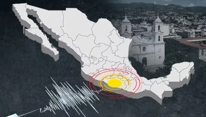
A 6.2 tremor in Mexico shook the southern region of the country
A 6.2 tremor in Mexico shook the southern region of the country, on the border with Guatemala; generating alert among authorities.
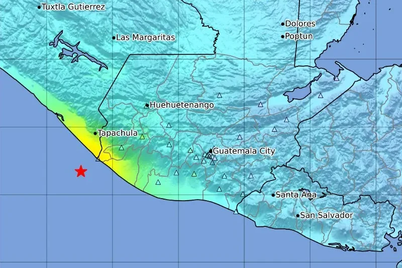
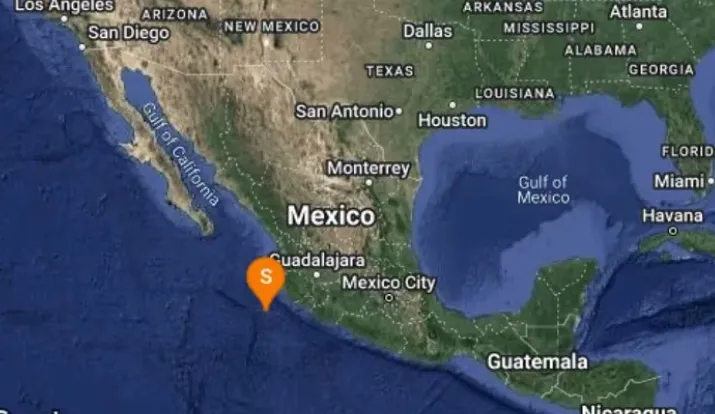
The 6.2 tremor in Mexico was registered 34 km southwest of Brisas Barra de Suchiate, Mexico.
The maximum intensity of V was in the municipality of Quetzaltenango, department of Quetzaltenango.
The 6.2 tremor in Mexico occurred in the North Pacific Ocean off the coast of Chiapas, Mexico, early Sunday morning, May 12, 2024 at 05:39 local time (GMT -6).
Notably, the tremor had a very shallow depth of 10 km and was felt over a large region.
The shallow depth of the 6.2 Mexico tremor meant that it was felt stronger near the epicenter than a deeper earthquake of similar magnitude would be.
A magnitude 6.4 earthquake struck west of the Mexico-Guatemala border on Sunday, according to the U.S. Geological Survey (USGS).
READ HERE: THE MYSTERIOUS ARRIVAL OF THE HOLY FAMILY IN CIUDAD GUZMAN.
The earthquake occurred 17 kilometers southwest of Brisas Barra de Suchiate, Mexico and at a depth of 75.4 kilometers.
On the other hand, according to the National Coordination of Civil Protection of Mexico, it confirms the absence of significant variations in the sea level, so it is estimated that there will be no danger for port operations or the population.
A 6.2 tremor in Mexico shook the southern region
As an incident associated to the earthquake, the National Coordinator for Disaster Reduction of Guatemala (Conred) reported a landslide in Ruta Cito Zarco, Kilometer 208 to 215 in Quetzaltenango and another landslide in La Calera and Peaje of the municipality of Zunil, Quetzaltenango.
The USGS alerted the earthquake as yellow, which means that “some casualties and damage are possible and the impact should be relatively localized”.
Subsequently, on the 6.2 quake in Mexico, the German Research Center for Geosciences (GFZ) issued a second report.
It listed the quake at magnitude 6.3. A third agency, the European-Mediterranean Seismological Center (EMSC), reported the same earthquake at magnitude 6.4.
According to preliminary seismic data, the earthquake was probably felt by many people in the epicenter area.
It should not have caused significant damage, except for objects falling from shelves, broken glass, etc.
So far, it is unclear whether there has been any impact on coastal communities.
While Cihuatlán was the epicenter of another earthquake in Mexico of 4.3 magnitude that surprised the residents of the state of Jalisco this May 12 at 4:26 Central Time.
On May 10, another earthquake was reported in Mexico, but of lesser magnitude.
According to the National Seismological Service (SSN) at 15:51 hours a 3.8 earthquake was registered south of Petatlan, Guerrero at a depth of 15.1 kilometers.
Information from the National Seismological Service indicates that an average of 40 earthquakes are registered in the country per day.
Earthquakes in Mexico are more frequent than in other countries in the Americas.
Mexicans are used to this type of events, since the country is located in a zone of high seismicity.
It is worth remembering the great affectation of the 1985 and 2017 earthquakes, which caused great havoc throughout the length and breadth of the Aztec territory. However, there are records of even more destructive movements in the country’s history.
On March 28, 1787, the strongest earthquake in Mexico so far was recorded in Oaxaca. It is estimated to have had a magnitude of 8.6 and was followed by a tsunami that reached 6 kilometers beyond the coast.